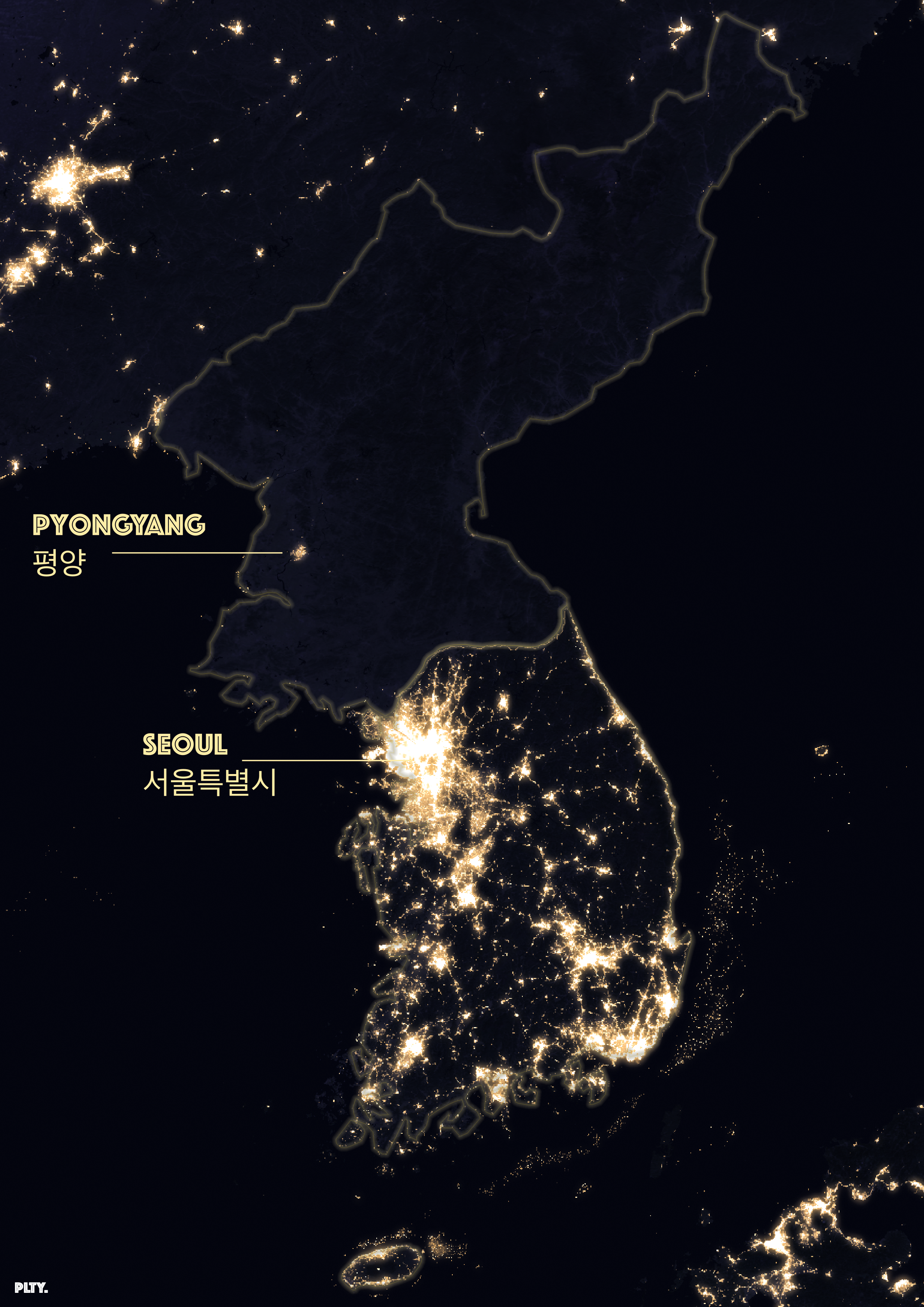
Data from Earth at Night (NASA). I wanted to showcase the difference in South (urban) and North Korea (rural) and it is quite stark.
Made in qGIS.
cartographer 𖡼 designer
Data from Earth at Night (NASA). I wanted to showcase the difference in South (urban) and North Korea (rural) and it is quite stark.
Made in qGIS.
